Contrails Over the Grand-Place: The One Part of Brussels Nobody Preserved
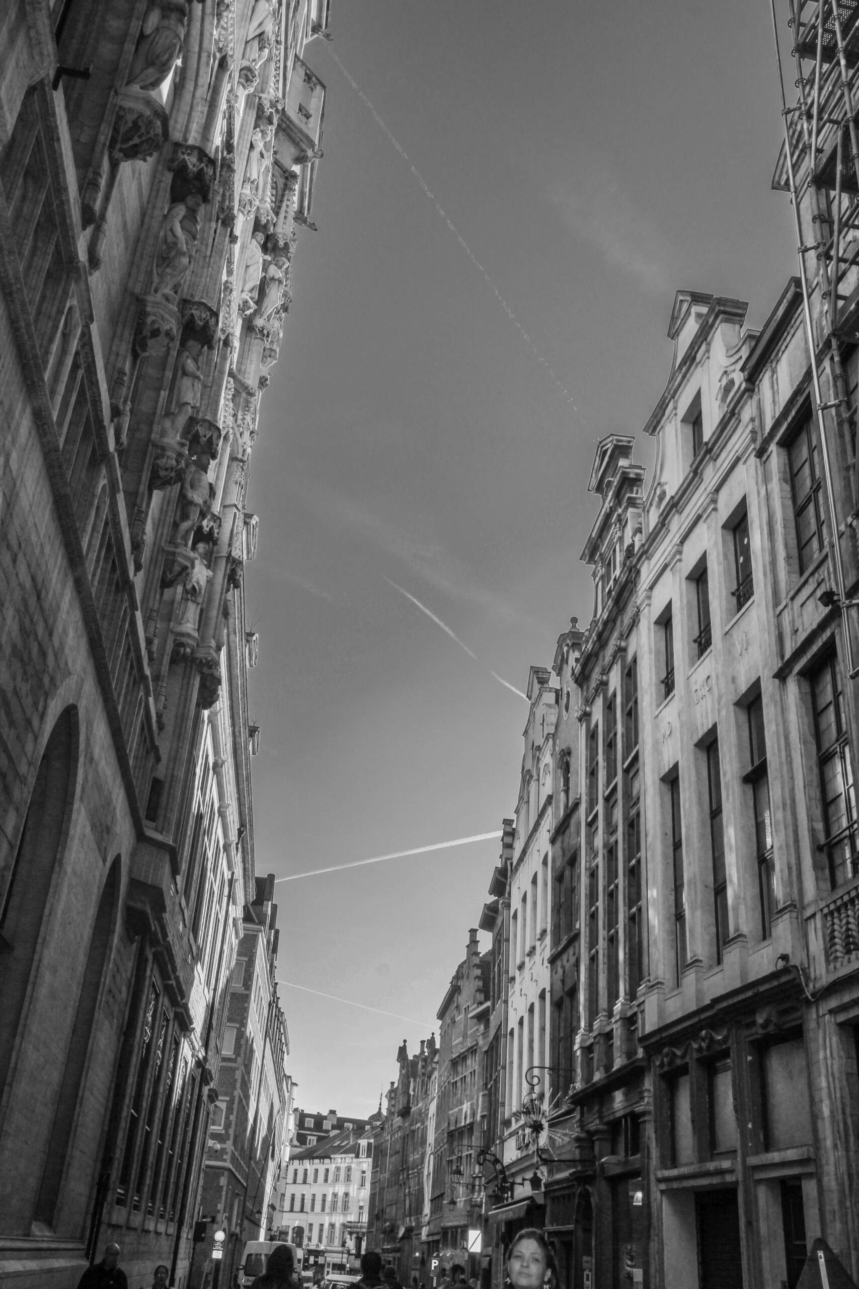
I went to Brussels to photograph a World Heritage site and came home with a picture of the sky. The Grand-Place is in the frame, barely. A sliver of the Town Hall on the left with its rank of statues on corbels, a run of gabled houses on the right, and between them a long grey wedge with two aircraft trails crossing it.
Everything below the rooflines is legally frozen. The square went onto the UNESCO list in 1998, and the protection is granular in the way heritage protection always is. Shopfront lettering, paint, the mortar you point the brick with, the colour of an awning. There is a whole apparatus of committees deciding what a facade is allowed to look like, and it applies to a strip of city about two hundred metres long.
Above the gables, nothing. No committee, no register, no view corridor. The sky over the most protected square in Belgium is the only part of the composition that no one is charged with keeping the same.
Which is funny, because it’s the part being managed hardest.
The airspace is run from about six kilometres away
Brussels is not just under the trails. It’s where they’re arranged. EUROCONTROL keeps its headquarters in the city, and the Network Manager Operations Centre that balances traffic flow across most of the continent sits there too. The upper airspace directly overhead is worked from the Maastricht centre, which handles Belgium, the Netherlands, Luxembourg and a chunk of north-west Germany as one block rather than four national ones.
So the two lines in my photograph are an output. Somebody assigned those levels and those headings, and a few kilometres from the tourists queueing for waffles there’s a room full of screens where the decision was made.
Nothing about that is visible from the street. It’s the least conspicuous heavy infrastructure in Europe.
Both halves of the picture invert
Here’s the part I keep turning over. The half everyone calls authentic isn’t very old, and the half everyone calls empty is densely governed.
In August 1695 a French army shelled Brussels for three days and flattened the square. The Town Hall tower survived mostly because it was what the gunners were aiming at, which is its own kind of joke. The guild houses you photograph today went up fast afterwards, inside a few years, and the statues on the Town Hall front are largely nineteenth-century replacements. The Grand-Place is a reconstruction that got old enough to count.
Meanwhile the grey wedge above it, the bit tourists crop out, runs on sectorisation and flow measures and a set of rules revised continuously.
One half is a preserved copy. The other half is a working system that leaves no trace except on days when the air is dry enough to hold a line.
Shoot the sky
Practical note, since this is a photography post underneath everything else. Narrow streets in the Low Countries are a dynamic range trap. Sunlit stone at the top, deep shade at the bottom, and a sky that blows out the moment you expose for the arcade. Black and white solves it, or at least stops you fighting it.
But contrails only do compositional work in mono if you go and find them. They’re the only diagonal in a scene made entirely of verticals. Two of them crossing gives you a structure the buildings can’t.
I framed for the architecture. The picture turned out to be about air traffic.